Gooty Fort: Neglected Historical Monument at the brink of Extinction

Speckled like a Conch - amid the Gooty Plains - The Fort has Many Stories To Tell- But there are neither the Spectators nor the protectors- Unmindful of the real treasure some innocent dig it away for the hidden treasures - Leaving Just the dust and the mute rocks - ITS THE STORY OF GOOTY FORT- one of the oldest forts of Andhra Pradesh surviving the tests of time and vanadalisers
Being born and brought up in (undivided) Andhra Pradesh, I haven't heard that a place called Gooty existed in Andhra Pradesh. It was not until 2008, when my first posting (Indian Railways) was in Gooty - I came to know the correct pronounciation as 'Gutti' rather than what looks like rhyming with tourist Parasdise OOTY. My assosciation continued with Gooty and Guntakal Diesel Loco Sheds for four years from 2008 to 2012 - both in the Anantpur district of Andhra Pradesh. Gooty and Guntakal both railway towns are separated by 30Kms and connected by one of the nice roads of Andhra (rather India). When I used to ply on the Gooty - Guntakal Highway my attention was always drawn by a rocky structure high up the hill in Gooty. That is the Gooty Fort at around 300m above the sea level. Cupious with the absence of any multistoreyed buildings, except a few duplex houses - the Fort could be seen from quiet long distances in and around Gooty.
The everytime I used to see that fort, I always wanted to vist it. So in my roughly two and half years stay in Gooty, shunning all the daily routines I have managed to visit the Fort four times. Out of four, Once I have gone to the top of the peak. Its really a marvel but now is in pulverised and dusted state. Most people of the Andhra aren't even aware of the place Gooty and more hardly any one knows about the Fort existing there. There is no much authentic information I could find about the fort, but it is known to have existed from the times of Sri Krishna Deva Raya and even before Hara Hara and Bukka, the founders of Vijayanagara Empire.
Some History..
It is one of the oldest hill forts of Andhra Pradesh.The earliest inscriptions found in this place are in Kannada and Sanskrit which states that this fort belongs to 7th century. It also states that Gooty was first under the rule of Ashoka. This can be known by the presence of a small Buddha Stupa near Gooty. Yes Yerragudi near Gooty is one of the 10 Major Rock Edicts of Asoka in India. Details at this news article of The Hindu . List of Asoka Edicts on Wikipedia.
Sri Krishnadevaraya of Vijayanagara Empire was one of the rulers of this place. Later, it came under the rule of Hyder Ali and then Tipu Sultan.
As per one of the inscriptions, the place was called as 'Gadha' meaning "Fort" while an inscription of Bukkaraya, the Vijayanagaran monarch, mentions this place as "King of Forts".
The Gooty Kaifiyat (municipal records) states that The Fort was captured by Mir Jumla and was subsequently under the charge of Qutub Shahi chiefs. Later in the year 1773, the fort was taken over by Hyder Ali and over a period of time it fell into the hands of British. The fort was also conquered by the Marathas under Murari Rao. This can be known by a small pavilion of polished lime stone called 'Murari Rao's seat', found in the fort.
After the attack of British Col. Browser, who took over the fort, found it to be commanded by a Zeruwar Khan, a Brahmin who became Muslim.At last, Asaf Jahi ruled this place till the India got independence and the area merged with Union of India and lastly converted into Andhra Pradesh on 1st Jan 1960.
One of the graves in the premises points to the fact the Fort was in occupation of the British from 1817 onwards. Another grave epitaph points to the fact there was cholera in Gooty in 1824, in which many a british soldiers perished.
The Palace in the court yard seems to have been razed to ground by the British and all its wealth seems to have been plundered. The British hatred towards Tipu Sultan is well known fact since Tipu tried to align with the French to stall the progress of British East India company & empire in India.
In hope of a blessed Immortality Herein Lieth the Remains of M W Mason, Conductor of Ordinance on this Establishment Who departed this life on the 10th day of May1817. Aged 52 Leaving a disconsolate Widow And Large circle of Relations & Friends, To deplore his loss.
********* I heard a voice from heaven, saying Blessed are the dead that die in the Lord, For they rest from their labours.
Another Grave inscription or epitaph points to break out Cholera in 1824, wherein Lieutant William Grant Gordon 20th Regiment fell victim to Cholera Morbus on 16th July 1824. “ Cold my heart and dull my mind……..” so goes the epitaph.
Location
 |
 |
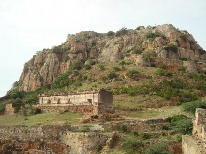
Atop is the King and Queen Palace - The building visible here is one of the Army buildings |
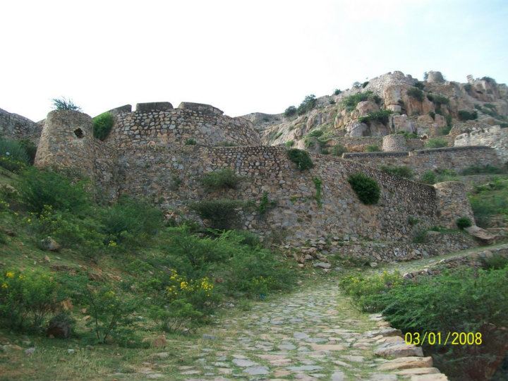
As you juggle through the path uphill - you will be puzzled whether they are hillocks or walls? |
This fort is located at 300mtrs above plain area in the Gooty. The geographical location of this fort is ideal and sufficient enough to save it from various intruders. The fort is located between geographical coordinates 15.12°N 77.63°E and the ground location is away from Ananthapur district is 52 kilometers. Kurnool-Bangalore highway is the main location of this fort.
This fort was made of granite rocks and the minarets or dome made over were constructed with fine stone, mortar and Lime ensuring the sustainability. The average altitudinal height of this fort from mean sea level is 345 mtrs. An approach road later converted into stairs to reach this fort is there. The various defenses are erected to reach the final fort. The location of this fort is in the design of a shell and thus saving it from various invasions. Attacks were made over this building but failed. Later with the huge arms and ammunitions, British took over. The paved way which is called as “Mar Gooty” is only the way to reach this fort.
Gooty is an important junction on Chennai- Mumbai , Hyderabad-Chennai, Hyderabad-Bangalore railway lines. It is connected by State Buses to all places of Anantpur district. Is is roughly 52 Kms from Ananthpur. There are various places to see around in Anantpur and adjacent kurnool and Kaddapah districts.
More Details..

The citadel of the fort is constructed on the westernmost circle of hillocks. It is a huge precipitous mass of bare rock and towers over the adjacent ones. The fort is approached by a paved path leading first to an outlying spur strongly fortified and known in former days as 'Mar Gooty'.
After passing through the fortifications, the pathway winds upward round steep sides of huge rock and reaches the summit where the citadel or 'qila' is situated. The fort is built in shape of a shell and having 15 forts with 15 main doors ('Mukhadwaralu').
The fortifications include a series of walls connected by 14 gateways flanked by bastions. Built more from a security point of view, none of the buildings in the fort have any sculptures or ornamental structures. There are two edifices, apparently a gymnasium and a powder magazine, and a small pavilion of polished lime stone called Morari Rao's seat, on the edge of the cliff.The fort of Gooty is an amalgamation of Hindu-Islamic architecture. The fort has numerous temples, including Nageswara Swamy Temple, Lakshminarasimhaswamy Temple and Ramaswamy Temple. A choultry built by Sir Thomas Munro also exists in the fort.
The peak of the fort commands excellent view of the town below and is said to have been a favourite resort of Maratha Ruler Morari Rao. Various wells were created at the top of the hill. The construction engineering on such a high place was amazing as the water management was done within the fort. It is stated that one of the well of this fort was also connected with a spring at the feet of hill but the source was not found even after the various surveys.
Testifying the Colonial Link with the fort - a graveyard at the enterance is filled with monument type edifices embedded with details of the soldier or colonel who have passed away or died with Cholera.
The Fort seems to be a part of hill and sprouts more as a stone out of the hill rather than as construction. Unless you escalate through the winding path its hard to recognise it as a man made, as it looks more natural.
The approach to the fort is through the hamlet, it is always better to undertake the trek early morning to enjoy the sunrise and it is better to carry plenty of water, since it is long trek to the peak watch tower. The entire for spreads over 10 km. It is advisible not to travel alone and go in groups of three or more. Its not only from security point of view but also a group you can enjoy more and take stunning snaps. This fort is almost aloof with few occassional visitors on weekdays and generally more number of visitors are spotted on weekends. Some locals plan for a picnic during Picnic Seasons.
 |
 |
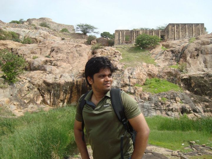
Here I am standing on a pond/well. Beneath me is the King or Queen's Palace. The walls have aquaducts(?) on it to collect the rain water in to the pond. |
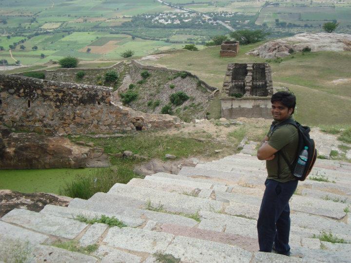
I am on the steps towards the Kind and Queen Palace - Are they looking like steps to heaven? Left side of the image you can see a greenish well- the hill tops are dotted by such wells |
Neglect and Plunder
There are various rumours - I don't know how much of it is true- that there are treasures horded inside the walls of the fort. There are stories of people getting rich overnight after finding some treasure there. Guided by these unfounded truths, some of the innocent locals carry out treasure hunts in the nights. During these hunts, most of the surviving structures have been damaged. Most of the structures which stood the wars and climate for centuries were broken into dust by the greed of some people to find out that lurring treasure. In my few visits to the fort, I used to find more structures basically the Entrance arches getting destroyed with every visit.
Being open to air (ofcourse it is quiet difficult to have an eye on such a mammoth structure) vandalism is quiet prevalent here. I was telling my experience three years back. I don't know how the current structure is now? Because of the neglect and further onslaught of treasure the Fort will be vanished into the ground - so as much of our History Got burried.
A news article in The Hindu dated 7th June 2014 reads the crying need of the fort - "The past glory of the Gooty fort returns if the government releases the funds required for its development as proposed two years ago. The fort which has an outer fortification is a shell-shaped one and has grand palaces for the king and queen atop the hillock.
The fort is further known for its ingenious water management by using almost 108 wells dug within the ramparts of fort walls for survival during times of war.
Currently, the fort is in a shambles for lack of funds.
Archaeological Survey of India (ASI) has prepared a project seeking funds to the tune of Rs. 8.50 crore which proposes total preservation of the fort and improvement of tourist amenities.
Speaking to The Hindu , the Conservation Assistant of the ASI, Mr. Satyam, has said that the ASI submitted a proposal to that effect to the Ministry of Tourism in 2012. After the jungle clearance, debris from the major breaches at the entrance of the fort will be cleared and the same building material will be used to reconstruct the old fort walls, says Mr. Satyam. He has also said that all the pathways within the fort will be restored so that they can walk from the entrance of the fort to the palaces of the king and queen."
Had you been to Gooty Fort or sorroundings- Please Share your experiences and enrich...
